QRP in the Driftless

-
Field Day, Day 2
The rain did quit sometime overnight, so I got up a bit before 4:00, made plenty of coffee, and got on the road back to Wildcat Mountain State Park, K-1480. Though I drove slowly and watchfully to avoid deer, I was at the park a few minutes before it opened at 6:00. (Deer are termed…
-
Field Day, Day 1
My planning for Field Day was kind of sketchy, and not at all ambitious, so I grabbed my radio pack after lunch and arrived at Wildcat Mountain State Park a bit before 2:00, or already almost an hour into the event. It took me about 20 minutes to set up the X6100 and the 20…
-
If it’s mid-June, then Field Day is right around the corner
is the thought that occurred to me this morning. Fourth weekend in June, yup, 24th and 25th, okay; I think I’m going to try for something a bit more organized than last year. But what, exactly? Well … weather permitting, definitely QRP, definitely carried in the pack (see the upcoming post about my current station-in-a-bag),…
-
Expedition to Oak Island
Just about every day since my return I have made a different start at writing this. Never quite satisfied with the result. Here goes, again. Friday, June 2nd One way or another I and all of my stuff were on the dock at the marina by 9 am, and the passage to Oak Island was…
-
Oak Island
Wow, got an excellent connection from the borrowed Verizon hotspot! I can kind of understand why Oak Island was “not yet activated” now. Getting here was not trivial, and neither was getting to the summit! 9 hours in the field and a bit more than 4 on the air, on and off, only got 13…
-
Off to Oak Island!
Up early, final packing (and unpacking!) almost finished. This is just a quick post before I turn this off and pack it up. This Lenovo Chromebook running Linux Mint is the only device that I have no means of charging for the next couple of days, so battery conservation will be crucial (assuming that I…
-
Oak Island expedition, day -1
8:45 local time, near dusk, overlooking the Madeleine Island ferry terminal. About 7 hours of driving up Highway 13 brought me to the Harbor’s Edge Motel in Bayfield, a lovely little town filled with cool stuff, including two bookstores; but everything but the restaurants and bars was unfortunately closed by the time I got in.…
-
Oak Island, W9/WI-041 ATNO and K-0764, Apostle Islands National Lakeshore
Well, I’ve been hinting around it for long enough. The big activation that I have been planning is coming up rapidly, (maybe, even after all my planning, a little too rapidly)! It will be Oak Island; K-0764 and W9/WI-041, June 2nd and 3rd. I will be preparing this post over the next few days, to…
-
I made a knee board
This is a great example of the kind of “just good enough to do the job” work that I do when I am in a big hurry; this whole thing took me one hour to make. First, how big to make it? A couple of minutes with a tape measure and (in this order) my…
-
I made an “octopus”
I got a little scare a few weeks ago as I was setting up; the power cord for the 6100 was not in its usual location! I found it only seconds later, attached to the external battery, but it got me thinking about backup for critical parts of the station equipment. This is one of…
-
No radio today, just a hike
Hiking has been taking the back seat a lot so far this year, in favor of radio operating, so when I looked at N0NBH’s solar conditions page and saw “poor” propagation in the forecast I decided to have a hike pure-and-simple! In the pre-dawn hours I filled one bottle with fresh hot coffee and a…
-
X6100 and EFHW at Wildcat Mountain
The weather today was a lot more pleasant than when I last activated K-1480, but I was using the same equipment. I planned to trim a few inches from the QRPguys EFHW to improve the SWR while I was setting up but it seemed to have the opposite effect … now I am wondering what…
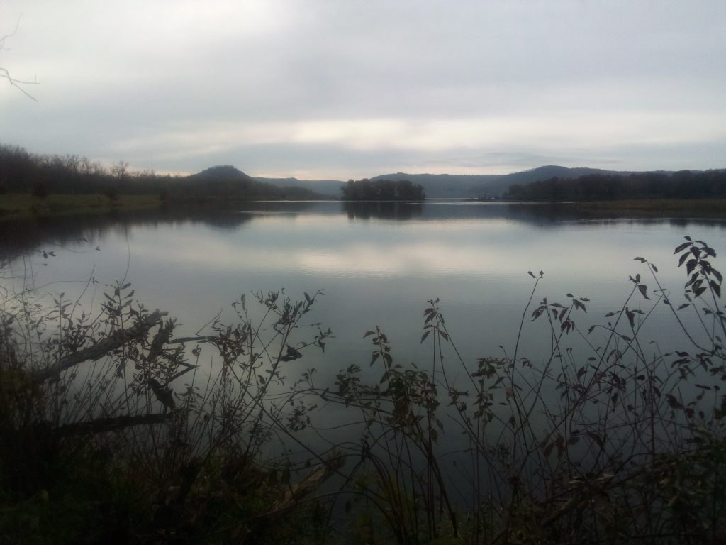
A backwater of the Mississippi River in the Upper Mississippi River National Wildlife Refuge on a gloomy, chilly day in early November, viewed from the Lower Diversion Dike Trail.
email link: